Table of Contents
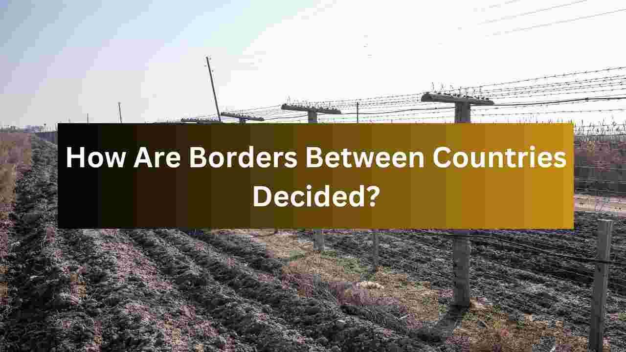
Borders are lines that separate different countries, regions, or territories from each other. They help define where one country ends and another begins. The way these borders are decided has changed over time, and there are many factors that influence how countries draw these lines. In this article, we will explore how borders are decided, what factors affect them, and how they can change.
What Are Borders?
Borders are the official boundaries of a country. They mark the physical and political limits of a nation’s territory. These lines can be natural, like rivers or mountains, or they can be man-made, based on agreements between different groups of people. Borders are important because they help governments control their land, resources, and people. They also help protect the country from outside threats.
Natural Borders
In the past, many borders were decided by natural features like rivers, mountains, or seas. These features are easy to recognize and difficult to change. For example, the river between two countries can form a natural border, where each side is clearly separated by the water. The Himalayan mountains between India and China are another example of a natural border.
Natural borders can make it easier for countries to decide where to draw their lines. However, not all natural features are clear enough to be used as borders. Some rivers change their course over time, which can lead to disagreements about where the border should be. Mountains, on the other hand, may not be wide enough to serve as a clear boundary.
Man-made Borders
In many cases, borders between countries are decided by humans rather than nature. Man-made borders are created through agreements between different governments, rulers, or groups of people. These agreements can happen in several ways:
- Treaties and Agreements: Countries often negotiate and sign treaties to set their borders. A treaty is a formal agreement between two or more countries. These agreements are often signed after long discussions and compromises. For example, the Treaty of Tordesillas, signed in 1494 between Spain and Portugal, divided the newly discovered lands in the Americas between the two countries.
- Wars and Conflicts: Sometimes, countries fight wars over land. After a war, the winner may get to decide where the border is drawn. For example, after World War II, many borders in Europe were changed to reflect the new balance of power. Countries like Germany had their borders shifted to make new countries, like Poland, or to divide them into smaller pieces.
- Colonialism and Imperialism: In the past, European countries took control of large parts of Africa, Asia, and the Americas. These colonial powers often decided borders without considering the people who lived there. In Africa, for example, the borders were drawn by European countries at the Berlin Conference in 1884-1885. The people who lived in those areas did not have a say in how the borders were set.
- Negotiation and Diplomacy: Sometimes, countries come together and peacefully agree on where the border should be. Diplomacy is the process of negotiating and finding peaceful solutions to conflicts. For example, the United States and Canada share the longest international border in the world, which was decided through negotiations and peaceful agreements.
The Role of Geography
Geography plays an important role in determining borders. Geography refers to the physical features of the earth, such as mountains, rivers, deserts, and seas. These features can make it easier or harder to establish a border. For example, the Sahara Desert in Africa forms a natural barrier between many countries in the north and south. This has helped create borders between countries like Egypt, Libya, and Sudan.
On the other hand, geography can also create challenges. For instance, some areas may have valuable resources, like oil or minerals, which can lead to competition between countries. In these cases, countries may struggle to agree on where the border should be. Disagreements over borders are often based on the desire to control these valuable resources.
How Do Countries Decide Where Their Borders Should Be?
There are different ways countries can decide where their borders should be. This process can take a long time and involve many discussions and compromises. Here are some common methods countries use to decide their borders:
- Historical Claims: Sometimes, countries claim land based on history. They may argue that they have always controlled a certain area or that their ancestors lived there. These historical claims can be based on old maps, documents, or even stories passed down through generations. However, historical claims can be complicated and difficult to prove, especially if the land has changed hands many times.
- Cultural and Ethnic Considerations: People living in a certain area often share the same culture, language, or religion. In some cases, countries may draw borders to separate people who belong to different ethnic groups. For example, in Africa, many countries were divided by the colonial powers without considering the people who lived there. This has caused problems because different ethnic groups were forced to live together in one country, leading to conflict and tension.
- Economic Interests: Countries may also decide on borders based on economic reasons. For example, if a country has valuable natural resources, like oil or minerals, neighboring countries may want to control the land that contains these resources. Economic interests can lead to border disputes, as countries compete for control of valuable land.
- International Law and Organizations: International law is a set of rules that countries agree to follow when dealing with each other. Organizations like the United Nations (UN) work to ensure that countries respect each other’s borders. When countries cannot agree on a border, international organizations may step in to help resolve the dispute. The UN often works to help countries reach peaceful solutions to border conflicts.
Why Do Borders Change?
Borders can change for many reasons. Sometimes, borders are moved because of new agreements, wars, or other political events. In some cases, countries may decide to change their borders because the people living in the area want it. For example, some regions in Europe, like the Czech Republic and Slovakia, peacefully separated and created new countries in the early 1990s.
Other times, borders change because of natural events. Earthquakes, floods, or landslides can sometimes change the landscape, making it unclear where a border should be. When this happens, countries may need to negotiate a new border.
Conclusion
Borders between countries are not always simple lines drawn on a map. They are the result of many factors, including history, geography, culture, economics, and political decisions. Borders help define where one country ends and another begins, but they can also be the cause of conflicts and disagreements. Over time, borders have changed, and they may continue to do so in the future. Understanding how borders are decided helps us appreciate the complexity of the world and the challenges that countries face in maintaining peaceful relationships with their neighbors.
The process of deciding borders is not always easy, but it is a crucial part of how countries interact with one another. Whether through treaties, diplomacy, or even war, borders shape the way countries are organized and help define the places where people live.
You May Also Like: What Are the Smallest Countries in the World?


Designed By: masterlal.com


")